Peter
I have created experimental version with support for tuning clusterizartion threshold. So far I cannot guarantee it will make it to oficial release or implementation will remain the same. But at least this is the start, and you will be able to test this fucntionality and see if this actually solves the problem.
Since this is experimental version, I will not be publishing link here, I will send it to you in separate email instead. But here how it works. In this version there is new Prefences dialog, and it has “Advanced” tab. Here you can set your custom threshold.
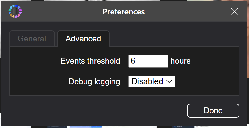
By default it is set to 6 hours, and this also defines the distance threshould using formula maxDistance = X hours * 5 km/per hour (which is walking speed). So far there is no way to set distance separately from time. If you would like to limit distance to, say 100m, then you will need to set time threshold of 0,02 hours (basically 1,2 minutes)
As I said this is very experimental verison and I am looking forward to your feedback, so we can make it better. Please experiment with this version and share what you think.
One more important thing, new setting will only affect clusterization of NEW photos. Existing events will not be changed. So, If you need to re-cluster some subset of your photos, there are few ways to do that:
- Re-index whole resource. Just remove it in “Library locations” dialog and add once again. This will trigger full reindex of whole resource, including rebuilding event clusters
- If you don’t need to reindex whole resource and only looking to reindex small subset of it, you can just rename or move directories you want to reindex. It will have same effect as removing them from library and adding again.
